Naviam Products
Naviam offers a powerful suite of products designed to enhance and simplify your Maximo experience. From mobile apps and geospatial tools to advanced scheduling, reporting, and vendor management solutions—our products improve productivity, streamline operations, and give you greater control over your asset management environment. Everything works smarter with Naviam.

Smarter Mobile Tools for Maximo
Opqo by Naviam
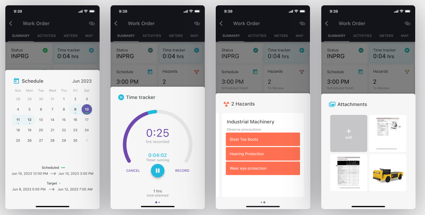
Opqo delivers a clean, efficient mobile interface for IBM Maximo—designed to be simple to buy, configure, and use. With no software to install on your servers and no upfront project required, Opqo makes getting started seamless and flexible. It’s fully process-driven and incredibly easy, yet powerful enough to support real-world field operations—even offline.

EZMaxMobile by Naviam
EZMaxMobile is a powerful mobile solution for IBM Maximo, offering real-time and offline access, advanced features, and global scalability to boost field productivity and streamline Maximo operations.

Fingertip by Naviam
Fingertip by Naviam is a configurable, offline-capable mobile solution for Maximo that brings essential asset, work, and inventory management to field teams—without added infrastructure, custom development, or deployment delays.
Simplified Operations Management

Naviam Planner
Naviam Planner simplifies Maximo maintenance scheduling with an intuitive, drag-and-drop interface. It optimizes resource planning, improves visibility, and reduces downtime—helping teams manage work orders efficiently in real time.

Naviam Request
Naviam Request simplifies service requests with a user-friendly portal that connects employees, service teams, and Maximo in real time. Streamline submission, improve response times, and boost communication—all in one solution.

Integrated GIS for Maximo

PowerSync
Automated data synchronization that ensures seamless updates between key enterprise systems, eliminating manual processes and maintaining data accuracy.

Workflows
Advanced GIS data integration, keeping spatial and asset information synchronized across platforms for more reliable asset tracking and infrastructure management.

MapEngine
A high-performance GIS mapping solution that enables fast, interactive, and responsive spatial visualizations, optimized for desktop and mobile.

Aerial Inspection
(Transmission Line Aerial Patrol Inspection App) – A specialized iPad-based tool designed for aerial patrol inspections, with automated structure detection, GIS integration, and offline capabilities.
Explore the Full Power of Naviam Products
Explore the Full Power of Naviam Products
From the field to the office, our tools unlock the full potential of your Maximo environment. Ready to work smarter? Let’s get started.
.avif)